The High Line Canal Trail was designated a National Recreation Trail in 1978. Kara Pearson Gwinn
Crews began digging the High Line in 1879. Courtesy of Denver Water
Measuring 71 miles, the 130-year-old High Line Canal is changing with Denver. Kara Pearson Gwinn
High Line Canal at Dry Creek on July 24, 1935. Courtesy of Denver Water
Point at which the canal bank was cut in September 1933. Courtesy of Denver Water
Planners have already begun to address one crossing at Hampden Avenue and Colorado Boulevard. Kara Pearson Gwinn
Denver Water intends to continue to deliver irrigation water to 70 or so active contract holders. Courtesy of Denver Water
Measuring 71 miles from canyon to plains and touted one of the nation's longest linear parks, the 130-year-old High Line Canal is evolving with Denver. Planning for its future is underway.
You'll find the High Line Canal's first headgate just north of Waterton Canyon's rocky mouth, at a diversion dam on the South Platte River. That dam's been closed for repairs, though, since the original structure was wiped out in a flood in 2013. Construction on the dam should wrap up next month -- too late for this year's run.
Denver Water owns the High Line, and contracts with seven parks and recreation agencies from Douglas County to Aurora to maintain the canal's bordering trails and greenways. "Other than where the diversion dam broke, High Line is 100 percent functional," says , says Tom Roode, Denver Water chief of operations and maintenance
.
Despite rumors to the contrary, Denver Water intends to continue running its canal, sending irrigation water to 70 or so active contract holders situated between Waterton Canyon and Fairmount Cemetery, located at about mile 48 on the 71-mile High Line Canal Trail.
Canal users range from wildlife refuges and golf courses to private citizens filling small ponds on their private property. "Current customers," Roode says, "will always have a water supply, no matter what the future beholds for the canal."
Running the canal is simple: Denver Water puts water in at the canal's headgate, and the High Line takes care of the rest. Named for the engineering principle on which it was designed, Denver's High Line -- like others in the state -- follows the natural contours of the terrain, dropping a couple of feet each mile, transporting water with gravity, as opposed to a pump or electricity. "Picture a marble rolling down a smooth path really, really slowly," says Roode.
In good water years, when it has the rights to do so, Denver Water runs its canal two or three times -- in the spring and fall, and the summer, perhaps -- transporting 120 to 150 cubic feet of water per second, or roughly half the quantity of water it delivered in its heyday, when the canal had 140 headgates and twice as many customers.
Historical interpretations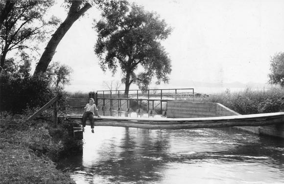
![]() High Line Canal at Dry Creek on July 24, 1935.
High Line Canal at Dry Creek on July 24, 1935.
The English Canal Company -- through one of its subsidiaries, Northern Colorado Irrigation Co. -- began working on the High Line in 1879, after striking a deal with Kansas Pacific Railway to purchase up to 400,000 acres of excess railroad-grant lands for $1.25 to $2 per acre in exchange for the construction of a canal that would convey water for irrigation.
"Railroads couldn't sell arid land in the middle of nowhere," explains Barbara Stocklin-Steely, founder of Denver-based Square Moon Consultants, a historic preservation and planning consulting firm. "The railroad company came up with the idea of building a canal, and selling water rights at the same time it sold land."
Prominent Colorado engineer Edwin S. Nettleton was brought on for planning, and the canal was built between 1879 and 1883, during Denver's original gold boom. It was an overly ambitious project from the get-go. The canal was designed to irrigate 120,000 acres. That number, explains a spokesperson for Denver Water, was pared down to 80,000 acres, then 40,000 acres; only 20,000 acres are actually under cultivation.
"The High Line was a major water system when it was first created, but even then it wasn't very profitable because it's a leaky little canal," says Harriet Crittenden LaMair, executive director for the High Line Canal Conservancy.
What's more, Northern Colorado Irrigation Company was late filing for water rights; by 1879, 87 holders were already senior to the High Line. "The canal has always struggled as a good, solid water source," explains Roode, noting that it often went empty during dry periods. Located about 100 miles southwest of Denver near Hartsel, Antero Reservoir was built to supplement the High Line's supply, and still operates today, except in "really tough drought years," says Roode, pointing to 2002 and 2012.
The High Line changed hands a couple of times, until Denver Water purchased it -- along with Antero Reservoir -- from the city in 1924. The leaky canal delivered water to many of its original contract holders for the next six decades, until customers gradually began coming off of the canal in the 1980s.
"We've always known the canal is an inefficient way to deliver water," Roode says, noting that 60 to 80 percent of water put into the canal is lost to seepage and evaporation. "Now," LaMair adds, "there are better, more sustainable and economically feasible ways to bring water to customers. For example, the Rocky Mountain Arsenal, once a major canal customer, converted to a recycled water system in 2003.
"The canal's original purpose has changed," Roode says. To that end, the High Line Canal Conservancy and Denver Water have undergone a comprehensive planning project to identify new long-term uses for the space.
From irrigation to recreation
As far as LaMair is concerned, "Recreational use has surpassed functional use" for the canal. Spanning 11 governmental jurisdictions (including Denver, Aurora, Greenwood Village and Highlands Ranch), winding through residential neighborhoods, public parks, golf courses and industrial spaces, the High Line's abutting shaded path is one of the longest continuous urban trails in the country. Over 350,000 residents live within a mile of it, and, according to data reviewed by the Conservancy, more than 500,000 people use the canal path annually, for walking and hiking, biking, horseback riding and picnicking.
That path was a maintenance road that was closed to the public until the 1970s. A few years later, in 1978, the High Line Canal Trail was designated a National Recreation Trail by the U.S. Department of the Interior. "That was the beginning of the canal's evolution into a higher purpose as a greenway," LaMair says, adding that the trail "is more than a recreational amenity. It's a wildlife habitat, a community connector and a mobility corridor."
As the canal's original purpose wanes, LaMair and her cohorts have come together through the High Line Canal Conservancy, to create a vision plan for future use. Formed in 2014 and comprised of 14 board members plus 50 advisors, the Conservancy's members see a need for private investment in public spaces. "There aren't enough taxes ever to do what everyone wants," says LaMair. "Parks," she adds, "Don't get the funding other agencies do."
While Denver Water will continue to manage the canal for the foreseeable future, it gave the Conservancy permission to create a vision plan for the High Line, and that plan began to materialize by way of a four-part series of Conservancy-sponsored open houses that kicked off in June.
Through October, the Conservancy hosted a dozen public gatherings, and engaged about 3,500 residents through meetings and online surveys. The idea, LaMair says, it to figure out what matters most to community members.
Visions for the future 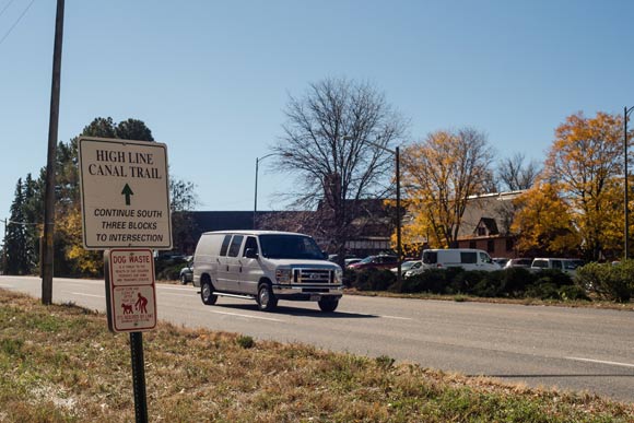
![]() Planners have already begun to address one crossing at Hampden Avenue and Colorado Boulevard.
Planners have already begun to address one crossing at Hampden Avenue and Colorado Boulevard.
Resident priorities, LaMair says, have been the Conservancy's "guiding principles" when creating its vision plan. The public's highest priority, LaMair begins, is keeping the canal natural. "From Douglas County to urbanized Denver, everyone wants a natural refuge," she says.
Preservation is key in executing this element of the vision plan, and land acquisition isn't out of the question, either. The canal corridor, LaMair explains, isn't very wide. "Another goal," she says, "is to preserve additional open spaces, and create pocket parks around the canal."
Beyond preserving the canal's natural landscape, there's a desire to preserve its history, too. The Conservancy hired Stocklin-Steely's Square Moon Consultants to do a reconnaissance survey, to identify the canal's natural resources -- infrastructures including dams, gates and flumes -- and its historical resources, such as old farmhouses that once used the canal. Stocklin-Steely wrapped up her survey in September after examining 191 different properties along the canal; she says it's "the first comprehensive look at canal history for its full 71 miles."
"One big takeaway," she says, "is that there's a very small number of historic farmsteads left along the canal. There isn't much in the way of historic interpretation along the trail." Recommendations in a report issued to the Conversancy last week include a call for historic interpretation along the trail, in the form of digital apps and/or signs.
Beyond safeguarding nature and history, locals intend to protect neighborhood character, too. Hence, the vision plan outlines five distinct character zones along the canal, and requests a "varied" trail. "The public wants the trail to have its own unique elements in all of the different communities," LaMair explains.
Her penultimate draft calls, too, for enhanced connectivity. There are 81 at-grade crossings on the canal's trail, and some are "major challenges," LaMair says, pointing to Santa Fe Drive in Douglas County.
Meanwhile, Denver, Cherry Hills Village and Arapahoe County have already begun to address one such crossing problem at the intersection of Hampden Avenue and Colorado Boulevard. Funding has been secured to reroute the trail underneath both busy roads next to Denver's Wellshire Golf Course, and construction is expected to begin in 2017.
Degraded conditions have left some sections of the trail unusable; the Conservancy addresses physical repairs, along with connectivity, too, which has been an ongoing issue for recreational users who would like to see the High Line linked to other trail systems, as well as nearby retail and amenities.
Finally, there's the question of what to do with the ditch itself. "It's not overly efficient; it has a lot of issues," says Stocklin-Steely. "But," she adds, "I think that maintaining it as an earthen ditch with water flowing is really kind of spectacular." It's certainly hard to argue that a concrete-lined canal would have the same appeal for meandering visitors.
The Conservancy's final vision element, then, explores ways to enhance the canal itself. "There's a lot of concern over how vegetation will survive if Denver Water ever stops running the canal," LaMair says. That's prompted Denver Water to consider the canal for stormwater filtration, which could give the old, leaky waterway new life as a detention pond of sorts.
"We don't know what the future holds," Roode says, adding, "The first question we have to answer is what the vision for the canal will be."
You can find a draft of the vision plan on the Conservancy's website.
Photos by Kara Pearson Gwinn and courtesy Denver Water.
Enjoy this story?
Sign up for free solutions-based reporting in your inbox each week.

Jamie Siebrase is a Denver-based freelance writer who who
writes about art, culture, and parenting for Westword and Colorado Parent.